Operational Areas
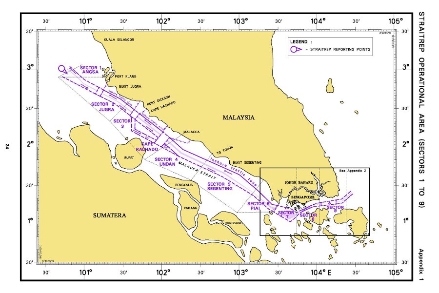
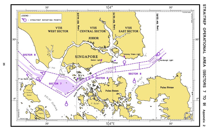
Maps of the STRAITREP operational areas.
The maps below show the STRAITREP operational areas from Sector 1 to Sector 9 and Sector 7 to Sector 9 respectively.
STRAITREP operational areas from Sector 1 to Sector 9

STRAITREP operational areas from Sector 7 to Sector 9

Sectors, VHF channels and VTS authorities
| SECTOR | VHF CHANNELS | VTS AUTHORITIES |
|---|---|---|
| Sector 1 | VHF Channel 66 | KLANG VTS |
| Sector 2 | VHF Channel 88 | KLANG VTS |
| Sector 3 | VHF Channel 84 | KLANG VTS |
| Sector 4 | VHF Channel 61 | KLANG VTS |
| Sector 5 | VHF Channel 88 | KLANG VTS |
| Sector 6 | VHF Channel 88 | JOHOR VTS |
| Sector 7 | VHF Channel 73 | SINGAPORE VTS |
| Sector 8 | VHF Channel 14 | SINGAPORE VTS |
| Sector 9 | VHF Channel 10 | SINGAPORE VTS |
